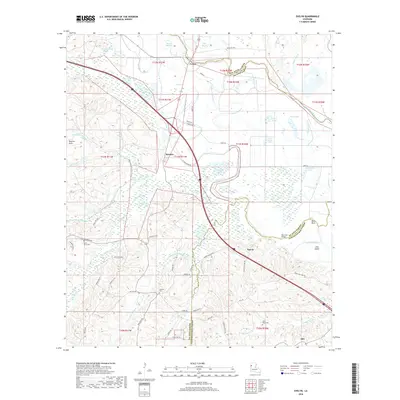
2018 Map of Evelyn
USGS Topo · Published 2018About this map
The Dolette Hills rise above a complex network of bayous and brakes where De Soto, Red River, and Natchitoches Parishes meet. This landscape is defined by its hydraulic character, featuring numerous named water bodies such as Chemard Lake, Telogue Lake, and Louies Brake that interlace with the winding courses of Bayou Pierre and Jims River. Small settlements like Evelyn, Rambin, and Harris are scattered across the terrain, connected by a web of parish roads that navigate the ridges and bottomlands. Genealogists and local historians can find significant landmarks including Saint Marys Cem, Wallace Cem, and Saint Pauls Cem near Ajax. The presence of Mary Cox Bridge and geographic markers like Jims Island and Buck Neck further highlight the intricate relationship between the local residents and the shifting wetlands of the Red River valley.
Find a feature on this map
72 named features on this map. Tap any name to fly to it.
Don’t see what you’re looking for? This feature index may not catch every label — zoom into the map to look around manually.
Map Details
Editions of this 2018 Evelyn Map
This is the sole edition of this map. No revisions or reprints were ever made.
Other maps of this area

1938 · Chemard Lake
USGS Topo · 1:31,680

1938 · Hollis Creek
USGS Topo · 1:31,680

1938 · Allen
USGS Topo · 1:31,680

1938 · Lake End
USGS Topo · 1:31,680

1941 · Pelican
USGS Topo · 1:62,500

1943 · Pleasant Hill
USGS Topo · 1:62,500

1944 · Pleasant Hill
USGS Topo · 1:62,500

1945 · Mansfield
USGS Topo · 1:62,500

1947 · Mansfield
USGS Topo · 1:62,500

1947 · Hanna
USGS Topo · 1:62,500