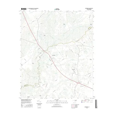
2016 Map of Evergreen
USGS Topo · Published 2016About this map
The Lumber River forms the central spine of this landscape on the border of Robeson and Columbus counties, where the river's winding course is surrounded by a dense network of swampy depressions and bays. Settlements like Boardman and Evergreen are situated along the primary transportation corridors, including the path of modern highways and older routes like Old Boardman Rd. The geography is defined by its hydrography, featuring numerous elliptical "Carolina Bays" such as Huckleberry Bay, Bennett Bay, and Bear Garden Bay, which are interspersed with more traditional water bodies like Wild Cat Lake and Blackfish Lake.
Find a feature on this map
97 named features on this map. Tap any name to fly to it.
Don’t see what you’re looking for? This feature index may not catch every label — zoom into the map to look around manually.
Map Details
Editions of this 2016 Evergreen Map
This is the sole edition of this map. No revisions or reprints were ever made.
Other maps of this area

1943 · Pages Mill
USGS Topo · 1:62,500

1953 · Chadbourn
USGS Topo · 1:62,500

1953 · Florence
USGS Topo · 1:250,000

1954 · Florence
USGS Topo · 1:250,000

1957 · Bladenboro
USGS Topo · 1:62,500

1962 · Fair Bluff
USGS Topo · 1:24,000

1962 · Fairmont
USGS Topo · 1:24,000

1962 · Fair Bluff
USGS Topo · 1:62,500

1972 · Southwest Lumberton
USGS Topo · 1:24,000
1976 · Southwest Lumberton
USGS Topo · 1:24,000