
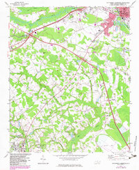
1972 Map of Southwest Lumberton
USGS Topo · Published 1975About this map
The Lumber River and its expansive network of wetlands define the landscape south of Lumberton in the early 1970s. This survey records a transition from the urban infrastructure of the city, including the Lumberton Municipal Airport and the Seaboard Coast Line railroad, to the rural agrarian reaches of Robeson County. The topography is dominated by numerous named wetlands such as Bear Swamp, Jacob Swamp, and Hog Swamp, which weave through the agricultural parcels and dictate the placement of roads and early settlements like Kingdale.
Find a feature on this map
48 named features on this map. Tap any name to fly to it.
Don’t see what you’re looking for? This feature index may not catch every label — zoom into the map to look around manually.
Map Details
Editions of this 1972 Southwest Lumberton Map
2 editions found
Other maps of this area

1943 · Pages Mill
USGS Topo · 1:62,500

1953 · Chadbourn
USGS Topo · 1:62,500

1953 · Florence
USGS Topo · 1:250,000

1954 · Florence
USGS Topo · 1:250,000

1957 · Bladenboro
USGS Topo · 1:62,500

1962 · Fairmont
USGS Topo · 1:24,000

1962 · Gaddysville
USGS Topo · 1:24,000

1962 · Fair Bluff
USGS Topo · 1:62,500

1972 · Northwest Lumberton
USGS Topo · 1:24,000

1972 · Pembroke
USGS Topo · 1:24,000