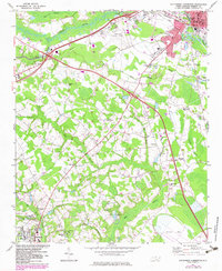
1972 Map of Southwest Lumberton
USGS Topo · Published 1983About this map
The Lumber River winds through the northern portion of this Robeson County landscape, defining a terrain dominated by extensive wetland systems like Jacob Swamp, Bear Swamp, and Hog Swamp. During the early 1970s, the area south of Lumberton was a network of small agricultural settlements and rural nodes connected by the Seaboard Coast Line railroad. Genealogical researchers will find significant detail in the numerous community landmarks, including the Rosenwald Sch in Fairmont and the Hilly Branch Sch further west. The map also documents a high density of family-named burial sites and rural congregations, such as the Prevatte Cem, Jenkins Cem, and Greenville Missionary Ch. The southern reaches are marked by the distinct oval depression of Juniper Bay, a characteristic geological feature of the Carolina coastal plain.
Find a feature on this map
60 named features on this map. Tap any name to fly to it.
Don’t see what you’re looking for? This feature index may not catch every label — zoom into the map to look around manually.
Map Details
Editions of this 1972 Southwest Lumberton Map
2 editions found
Other maps of this area

1943 · Pages Mill
USGS Topo · 1:62,500

1953 · Chadbourn
USGS Topo · 1:62,500

1953 · Florence
USGS Topo · 1:250,000

1954 · Florence
USGS Topo · 1:250,000

1957 · Bladenboro
USGS Topo · 1:62,500

1962 · Fairmont
USGS Topo · 1:24,000

1962 · Gaddysville
USGS Topo · 1:24,000

1962 · Fair Bluff
USGS Topo · 1:62,500

1972 · Northwest Lumberton
USGS Topo · 1:24,000

1972 · Southwest Lumberton
USGS Topo · 1:24,000