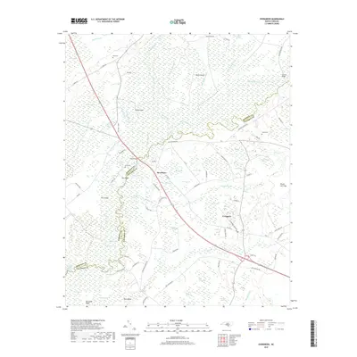
2019 Map of Evergreen
USGS Topo · Published 2019About this map
The Lumber River snakes through a complex network of wetlands and sloughs along the boundary of Robeson and Columbus Counties. This 2019 survey captures the water-managed landscape of the coastal plain, where man-made features like the Gum Swamp Canal, Riley Island Canal, and Big Br Canal cut through the natural bay forest and swamp. The settlement of Boardman serves as a central point along the thoroughfare, while Evergreen is situated to the southeast among numerous elliptical depressions known locally as bays, including Beks Bay and Scoggin Bay. Local history and genealogy are well-preserved through the identification of family-named sites such as Ward Cem, Britt Cem, and Jones Cem. The presence of Tar Lndg and Lennons Bridge highlights the historical importance of river crossings and water-based transit in this heavily wooded, hydrologically intricate region.
Find a feature on this map
100 named features on this map. Tap any name to fly to it.
Don’t see what you’re looking for? This feature index may not catch every label — zoom into the map to look around manually.
Map Details
Editions of this 2019 Evergreen Map
This is the sole edition of this map. No revisions or reprints were ever made.
Other maps of this area

1943 · Pages Mill
USGS Topo · 1:62,500

1953 · Chadbourn
USGS Topo · 1:62,500

1953 · Florence
USGS Topo · 1:250,000

1954 · Florence
USGS Topo · 1:250,000

1957 · Bladenboro
USGS Topo · 1:62,500

1962 · Fair Bluff
USGS Topo · 1:24,000

1962 · Fairmont
USGS Topo · 1:24,000

1962 · Fair Bluff
USGS Topo · 1:62,500

1972 · Southwest Lumberton
USGS Topo · 1:24,000
1976 · Southwest Lumberton
USGS Topo · 1:24,000