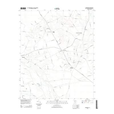
2014 Map of Evergreen
USGS Topo · Published 2014About this map
Lynches River flows through the southern portion of this Florence County landscape, defining a terrain of numerous named branches and bays. The area is characterized by a high density of rural burial grounds, providing significant data for genealogical research at sites like Evergreen Cem, Tabernacle Cem, and the Garden of Memories Cem. Small settlement nodes such as Evergreen, Gardner Crossroads, and Mathis Corner anchor the road network, while Willow Creek Siding suggests the area's historical connection to rail transport. The map also documents local landmarks like Cox Bay and Green Spring Br, reflecting the complex hydrology of the coastal plain. Notable family-named sites, including the Hewitt Cem and Turner Cem, further illustrate the long-standing community ties throughout this rural South Carolina district.
Find a feature on this map
105 named features on this map. Tap any name to fly to it.
Don’t see what you’re looking for? This feature index may not catch every label — zoom into the map to look around manually.
Map Details
Editions of this 2014 Evergreen Map
This is the sole edition of this map. No revisions or reprints were ever made.
Other maps of this area

1940 · Florence West
USGS Topo · 1:62,500

1940 · Florence East
USGS Topo · 1:62,500

1945 · Florence East
USGS Topo · 1:62,500

1945 · Florence West
USGS Topo · 1:62,500

1946 · Hyman
USGS Topo · 1:62,500

1946 · Lake City
USGS Topo · 1:62,500

1949 · Georgetown
USGS Topo · 1:250,000

1953 · Florence
USGS Topo · 1:250,000

1954 · Florence
USGS Topo · 1:250,000

1967 · Georgetown
USGS Topo · 1:250,000