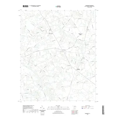
2020 Map of Evergreen
USGS Topo · Published 2020About this map
The Lynches River lowlands of Florence County define this landscape, characterized by a complex network of wetlands and namesake bays. Settlements like Evergreen and Gardner Crossroads anchor the road system, while smaller locales such as Mathis Corner and Willow Creek Siding suggest the rural transit and agricultural hubs of the region. The map is particularly dense with small family and community burial sites, providing a significant resource for genealogical research. Prominent locations include Evergreen Cem, Saint Paul Cem, and the Olive Grove Cem. The local geography is heavily marked by oval depressions known as bays, including Gregg Bay, Alligator Bay, and Dials Bay, which interrupt the drainage patterns of Cypress Cr and Willow Cr. These features, combined with named branches like Ward Mill Br, reflect the historical reliance on local watercourses for early industry and navigation in the South Carolina coastal plain.
Find a feature on this map
111 named features on this map. Tap any name to fly to it.
Don’t see what you’re looking for? This feature index may not catch every label — zoom into the map to look around manually.
Map Details
Editions of this 2020 Evergreen Map
This is the sole edition of this map. No revisions or reprints were ever made.
Other maps of this area

1940 · Florence West
USGS Topo · 1:62,500

1940 · Florence East
USGS Topo · 1:62,500

1945 · Florence East
USGS Topo · 1:62,500

1945 · Florence West
USGS Topo · 1:62,500

1946 · Hyman
USGS Topo · 1:62,500

1946 · Lake City
USGS Topo · 1:62,500

1949 · Georgetown
USGS Topo · 1:250,000

1953 · Florence
USGS Topo · 1:250,000

1954 · Florence
USGS Topo · 1:250,000

1967 · Georgetown
USGS Topo · 1:250,000