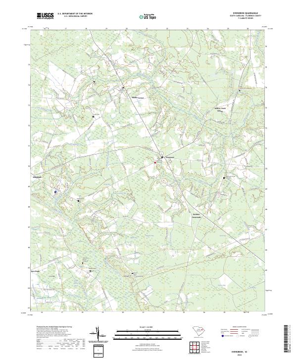
2024 Map of Evergreen
USGS Topo · Published 2024About this map
Evergreen Church and its adjacent Evergreen graveyard anchor this section of Florence County, where the landscape is defined by an intricate network of Carolina bays and blackwater streams. The geography is punctuated by distinctive oval depressions such as Gregg Bay, Alligator Bay, and Dials Bay, which shape the local road patterns and land use. To the west, the Lynches River provides a natural boundary, while the interior is crisscrossed by Willow Creek and Cypress Creek.
Find a feature on this map
128 named features on this map. Tap any name to fly to it.
Don’t see what you’re looking for? This feature index may not catch every label — zoom into the map to look around manually.
Map Details
Editions of this 2024 Evergreen Map
This is the sole edition of this map. No revisions or reprints were ever made.
Other maps of this area

1940 · Florence West
USGS Topo · 1:62,500

1940 · Florence East
USGS Topo · 1:62,500

1945 · Florence East
USGS Topo · 1:62,500

1945 · Florence West
USGS Topo · 1:62,500

1946 · Hyman
USGS Topo · 1:62,500

1946 · Lake City
USGS Topo · 1:62,500

1949 · Georgetown
USGS Topo · 1:250,000

1953 · Florence
USGS Topo · 1:250,000

1954 · Florence
USGS Topo · 1:250,000

1967 · Georgetown
USGS Topo · 1:250,000