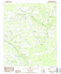
1986 Map of Evergreen
USGS Topo · Published 1987About this map
Evergreen and the surrounding Florence County countryside are defined by a complex network of wetlands and small agricultural communities in the mid-1980s. The landscape is dotted with numerous small bays—low-lying depressions such as Alligator Bay, Dials Bay, and Turner Bay—which punctuate the flat terrain between the Lynches River and the various branches of Willow Creek. This era shows a community anchored by its rural institutions, with dozens of churches and family cemeteries like Elizabeth Cem and St Paul Ch and Cem serving as focal points for local genealogy research.
Find a feature on this map
50 named features on this map. Tap any name to fly to it.
Don’t see what you’re looking for? This feature index may not catch every label — zoom into the map to look around manually.
Map Details
Editions of this 1986 Evergreen Map
This is the sole edition of this map. No revisions or reprints were ever made.
Other maps of this area

1940 · Florence West
USGS Topo · 1:62,500

1940 · Florence East
USGS Topo · 1:62,500

1945 · Florence East
USGS Topo · 1:62,500

1945 · Florence West
USGS Topo · 1:62,500

1946 · Hyman
USGS Topo · 1:62,500

1946 · Lake City
USGS Topo · 1:62,500

1949 · Georgetown
USGS Topo · 1:250,000

1953 · Florence
USGS Topo · 1:250,000

1954 · Florence
USGS Topo · 1:250,000

1967 · Georgetown
USGS Topo · 1:250,000