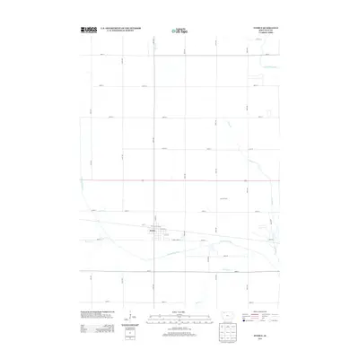
2013 Map of Everly
USGS Topo · Published 2013About this map
Everly serves as the primary hub of this Clay County landscape, where the grid of rural roads meets the diagonal path of the railway. The town is situated just north of the Ocheyedan River, which meanders eastward through the southern portion of the quadrangle. This area is defined by its deep agricultural roots, evidenced by the presence of Jensen Farms and the extensive network of numbered avenues and streets that partition the terrain into productive fields. To the north and east, several waterways including Stony Cr and the Little Sioux River drain the prairie. The geography reflects a late twentieth-century persistence of the small-town Iowa model, where water resources like Spring Cr and the river systems remain central to the local environment and settlement pattern.
Find a feature on this map
33 named features on this map. Tap any name to fly to it.
Don’t see what you’re looking for? This feature index may not catch every label — zoom into the map to look around manually.
Map Details
Editions of this 2013 Everly Map
This is the sole edition of this map. No revisions or reprints were ever made.
Other maps of this area

1954 · Fairmont
USGS Topo · 1:250,000

1958 · Fairmont
USGS Topo · 1:250,000

1966 · Spencer
USGS Topo · 1:24,000

1966 · Greenville
USGS Topo · 1:24,000

1970 · Milford
USGS Topo · 1:24,000

1970 · Hartley SW
USGS Topo · 1:24,000

1970 · Everly
USGS Topo · 1:24,000

1970 · Hartley
USGS Topo · 1:24,000

1970 · Royal
USGS Topo · 1:24,000

1970 · Lake Park SE
USGS Topo · 1:24,000