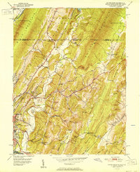
1951 Map of Evitts Creek
USGS Topo · Published 1951About this map
Cumberland and its southern extension, South Cumberland, occupy the valley floor where the Potomac River bends, framed by the steep rise of Wills Mountain. This mid-century survey illustrates the industrial and transit-heavy character of the region, anchored by the Baltimore and Ohio RR and the Pennsylvania RR corridors. Moving north into the Cumberland Valley, the landscape shifts toward agricultural and residential settlements like Cooks Mills and Hazen, while the eastern terrain is dominated by the ridges of Evitts Mountain and Martin Mtn.
Find a feature on this map
63 named features on this map. Tap any name to fly to it.
Don’t see what you’re looking for? This feature index may not catch every label — zoom into the map to look around manually.
Map Details
Editions of this 1951 Evitts Creek Map
2 editions found
Other maps of this area

1898 · Frostburg
USGS Topo · 1:62,500

1899 · Flintstone
USGS Topo · 1:62,500

1900 · Flintstone
USGS Topo · 1:62,500

1901 · Frostburg
USGS Topo · 1:62,500

1908 · Frostburg
USGS Topo · 1:62,500

1923 · Berlin
USGS Topo · 1:48,000

1927 · Hyndman
USGS Topo · 1:62,500

1929 · Berlin
USGS Topo · 1:62,500

1931 · Hyndman
USGS Topo · 1:62,500

1944 · Hyndman
USGS Topo · 1:62,500