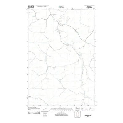
2011 Map of Ewartsville
USGS Topo · Published 2011About this map
Union Center and Ewartsville are the primary focal points of this rural Palouse landscape, where the agricultural road network follows the winding drainages of the eastern Washington hills. The topography is defined by the deep incisions of MacMurry Canyon and Wawawai Canyon in the southwest, contrasting with the productive uplands to the north. Waterways like Union Flat Creek and Wilbur Creek dictate the positioning of historical travel routes, including Wawawai Pullman Rd and Wilbur Creek Flat Rd. This area reflects a long-standing wheat-farming tradition, with names like La Follett Rd and Kamerrer Rd marking the family-owned farmsteads that have shaped Whitman County's geography for generations.
Find a feature on this map
25 named features on this map. Tap any name to fly to it.
Don’t see what you’re looking for? This feature index may not catch every label — zoom into the map to look around manually.
Map Details
Editions of this 2011 Ewartsville Map
This is the sole edition of this map. No revisions or reprints were ever made.
Other maps of this area

1910 · Pullman
USGS Topo · 1:125,000

1955 · Pullman
USGS Topo · 1:250,000

1958 · Pullman
USGS Topo · 1:250,000

1964 · Wilcox
USGS Topo · 1:24,000

1964 · Kirby
USGS Topo · 1:24,000

1964 · Colton
USGS Topo · 1:24,000
1964 · Albion
USGS Topo · 1:24,000

1964 · Colfax South
USGS Topo · 1:24,000

1964 · Ewartsville
USGS Topo · 1:24,000

1964 · Bishop
USGS Topo · 1:24,000