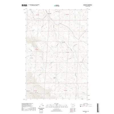
2020 Map of Ewartsville
USGS Topo · Published 2020About this map
Union Center and Ewartsville are the primary points of settlement in this part of Whitman County, set against a deeply incised landscape where agriculture and drainage systems dictate the local geography. The area is defined by a network of seasonal and perennial watercourses, including the prominent Union Flat Creek and Almota Creek, which have carved significant features into the terrain such as MacMurry Canyon and Buck Canyon. In the southern reaches, the land drops away into Wawawai Canyon, signaling the transition toward the Snake River breaks.
Find a feature on this map
33 named features on this map. Tap any name to fly to it.
Don’t see what you’re looking for? This feature index may not catch every label — zoom into the map to look around manually.
Map Details
Editions of this 2020 Ewartsville Map
This is the sole edition of this map. No revisions or reprints were ever made.
Other maps of this area

1910 · Pullman
USGS Topo · 1:125,000

1955 · Pullman
USGS Topo · 1:250,000

1958 · Pullman
USGS Topo · 1:250,000

1964 · Wilcox
USGS Topo · 1:24,000

1964 · Kirby
USGS Topo · 1:24,000

1964 · Colton
USGS Topo · 1:24,000
1964 · Albion
USGS Topo · 1:24,000

1964 · Colfax South
USGS Topo · 1:24,000

1964 · Ewartsville
USGS Topo · 1:24,000

1964 · Bishop
USGS Topo · 1:24,000