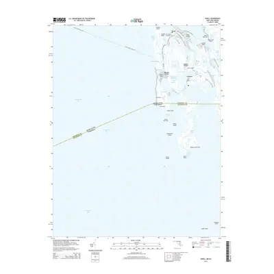
2014 Map of Ewell
USGS Topo · Published 2014About this map
Smith Island dominates this maritime survey, illustrating the isolated community structure of Maryland’s only inhabited island in the Chesapeake Bay. The three primary settlements of Ewell, Rhodes Point, and Tylerton are linked by a fragile network of local roads like Smith Island Rd and Caleb Jones Rd, while the surrounding landscape is a complex maze of marshy guts and inlets such as The Slough, Frances Gut, and Martin Gut. The map highlights the critical role of water transportation, showing the established ferry routes including the Point Lookout-Ewell Fry and the Crisfield-Smith Island Fry. Further south, the terrain fragments into uninhabited landforms like Shanks Island and Cheeseman Island, while the Maryland-Virginia state line bisects the marshes near Hog Neck and Oyster Point, marking the jurisdictional boundary in the heart of the bay.
Find a feature on this map
57 named features on this map. Tap any name to fly to it.
Don’t see what you’re looking for? This feature index may not catch every label — zoom into the map to look around manually.
Map Details
Editions of this 2014 Ewell Map
This is the sole edition of this map. No revisions or reprints were ever made.
Other maps of this area

1898 · St. Marys
USGS Topo · 1:125,000

1903 · Crisfield
USGS Topo · 1:62,500

1903 · Bloodsworth Island
USGS Topo · 1:62,500

1903 · Deal Island
USGS Topo · 1:62,500

1906 · St. Marys
USGS Topo · 1:125,000

1917 · Ewell
USGS Topo · 1:62,500

1920 · Crisfield
USGS Topo · 1:62,500

1942 · Terrapin Sand Point
USGS Topo · 1:24,000

1942 · Kedges Straits
USGS Topo · 1:24,000

1942 · Ewell
USGS Topo · 1:24,000