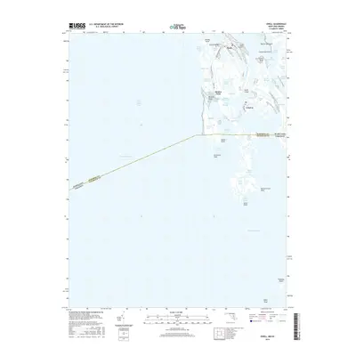
2016 Map of Ewell
USGS Topo · Published 2016About this map
Smith Island anchors this coastal survey, showcasing a unique insular community where the land is defined by a intricate network of waterways and salt marshes. The three distinct settlements of Ewell, Rhodes Point, and Tylerton are linked by local connectors like Smith Island Rd and Caleb Jones Rd, though much of the island's movement clearly relies on the water. The landscape is a maze of tidal features, from Big Thorofare and Rhodes Point Gut to the expansive Bare Marsh. This map provides a clear look at the Maryland and Virginia border as it cuts across the Chesapeake Bay, dividing Somerset Co from Accomack Co. Notable terrain markers like Amen Corner and Peachorchard Point highlight the names given by generations of residents to this fragile, low-lying archipelago.
Find a feature on this map
53 named features on this map. Tap any name to fly to it.
Don’t see what you’re looking for? This feature index may not catch every label — zoom into the map to look around manually.
Map Details
Editions of this 2016 Ewell Map
This is the sole edition of this map. No revisions or reprints were ever made.
Other maps of this area

1898 · St. Marys
USGS Topo · 1:125,000

1903 · Crisfield
USGS Topo · 1:62,500

1903 · Bloodsworth Island
USGS Topo · 1:62,500

1903 · Deal Island
USGS Topo · 1:62,500

1906 · St. Marys
USGS Topo · 1:125,000

1917 · Ewell
USGS Topo · 1:62,500

1920 · Crisfield
USGS Topo · 1:62,500

1942 · Terrapin Sand Point
USGS Topo · 1:24,000

1942 · Kedges Straits
USGS Topo · 1:24,000

1942 · Ewell
USGS Topo · 1:24,000