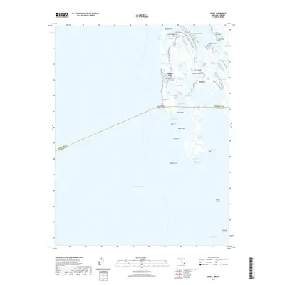
2019 Map of Ewell
USGS Topo · Published 2019About this map
Smith Island anchors this detailed study of the archipelago where Somerset County meets the Maryland-Virginia state line. The landscape is defined by a intricate network of waterways like Big Thorofare and Indian Creek, which isolate the primary settlements of Ewell, Rhodes Point, and Tylerton. These communities are connected by a few vital roads such as Caleb Jones Rd and Smith Island Rd, while much of the landmass consists of low-lying marshes and ridges including Orchard Ridge and Peachorchard Point.
Find a feature on this map
61 named features on this map. Tap any name to fly to it.
Don’t see what you’re looking for? This feature index may not catch every label — zoom into the map to look around manually.
Map Details
Editions of this 2019 Ewell Map
This is the sole edition of this map. No revisions or reprints were ever made.
Other maps of this area

1898 · St. Marys
USGS Topo · 1:125,000

1903 · Crisfield
USGS Topo · 1:62,500

1903 · Bloodsworth Island
USGS Topo · 1:62,500

1903 · Deal Island
USGS Topo · 1:62,500

1906 · St. Marys
USGS Topo · 1:125,000

1917 · Ewell
USGS Topo · 1:62,500

1920 · Crisfield
USGS Topo · 1:62,500

1942 · Terrapin Sand Point
USGS Topo · 1:24,000

1942 · Kedges Straits
USGS Topo · 1:24,000

1942 · Ewell
USGS Topo · 1:24,000