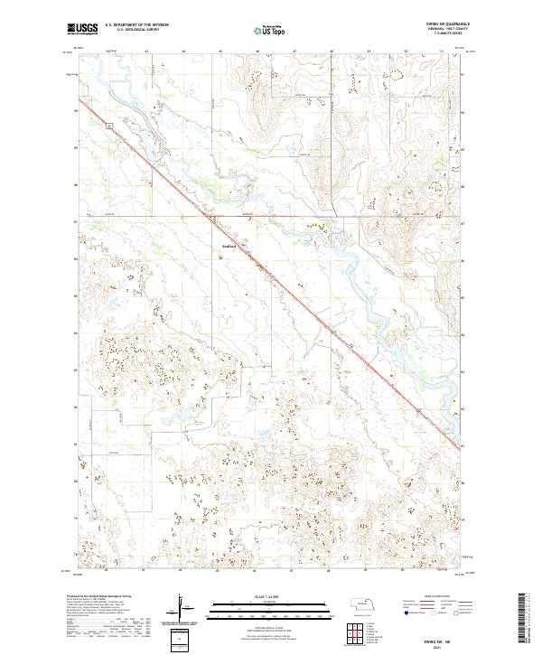
2021 Map of Ewing SW
USGS Topo · Published 2021About this map
Stafford sits at a critical intersection of Nebraska transit history, where the modern Cowboy Trl follows the diagonal path of the former Chicago and North Western Railway. The landscape is defined by the wandering course of the Elkhorn River, which carves through the northern half of the region, creating a complex system of oxbows and seasonal wetlands. To the northwest, the Chain Lakes reflect the river's historical shifts, while Learys Lakes punctuate the eastern marshlands. The southern portion of the quadrangle transitions into the characteristic sandhill topography of Holt County, marked by a sparse grid of section roads like Taylor Rd and Voyager Rd. This 2021 survey illustrates the endurance of small prairie settlements and the repurposing of old rail corridors for recreational use within a predominantly agricultural and ranching environment.
Find a feature on this map
24 named features on this map. Tap any name to fly to it.
Don’t see what you’re looking for? This feature index may not catch every label — zoom into the map to look around manually.
Map Details
Editions of this 2021 Ewing SW Map
This is the sole edition of this map. No revisions or reprints were ever made.
Other maps of this area

1955 · O'Neill
USGS Topo · 1:250,000

1958 · Inman
USGS Topo · 1:24,000

1958 · Page
USGS Topo · 1:24,000

1959 · O'Neill
USGS Topo · 1:250,000

1963 · Ewing SW
USGS Topo · 1:24,000

1963 · Venus
USGS Topo · 1:24,000

1963 · Ewing
USGS Topo · 1:24,000

1963 · Deloit NE
USGS Topo · 1:24,000

1963 · Deloit NW
USGS Topo · 1:24,000

1964 · O'Neill SE
USGS Topo · 1:24,000