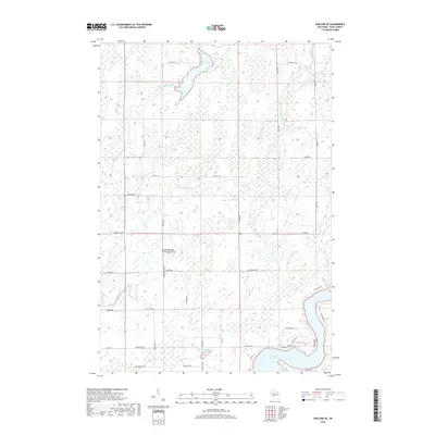
2018 Map of Exeland SE
USGS Topo · Published 2018About this map
The Thornapple River system dominates this Rusk County landscape, carving through a region defined by its significant water management and rural social hubs. The Dairyland Reservoir sits at the southeastern corner of the quadrangle, serving as a primary hydrologic anchor near the confluence of Crooked Cr and several smaller tributaries. Further north, the Lea Flowage and the winding Little Thornapple River illustrate the marshy, low-lying character of the upper terrain.
Find a feature on this map
45 named features on this map. Tap any name to fly to it.
Don’t see what you’re looking for? This feature index may not catch every label — zoom into the map to look around manually.
Map Details
Editions of this 2018 Exeland SE Map
This is the sole edition of this map. No revisions or reprints were ever made.
Other maps of this area

1944 · Exeland
USGS Topo · 1:48,000

1945 · Ingram
USGS Topo · 1:48,000

1947 · Exeland
USGS Topo · 1:48,000

1947 · Ingram
USGS Topo · 1:48,000

1947 · Sheldon
USGS Topo · 1:48,000

1948 · Ladysmith
USGS Topo · 1:48,000

1949 · Sheldon
USGS Topo · 1:48,000

1950 · Ladysmith
USGS Topo · 1:48,000

1953 · Rice Lake
USGS Topo · 1:250,000

1959 · Rice Lake
USGS Topo · 1:250,000