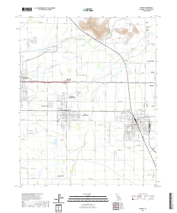
2021 Map of Exeter
USGS Topo · Published 2021About this map
Exeter and Farmersville anchor this 2021 landscape, illustrating the intricate water management systems of the San Joaquin Valley. The terrain is defined by a dense network of irrigation channels, including the Wutchumna Ditch, Pennebaker Ditch, and Consolidated Peoples Ditch, which divert water from the Kaweah River and Saint Johns River to support the region's agricultural productivity. To the north, the Venice Hills provide a rare topographic rise above the valley floor near Venice Cove. Family and community history is anchored by sites like Linnell Camp, Mitchell Corner, and the Exeter District Cem. The presence of numerous sloughs and cuts, such as Johnson Slough and Crocker Cut, reveals how natural waterways have been heavily modified to sustain the local economy and various settlements like Matchin and Venida.
Find a feature on this map
180 named features on this map. Tap any name to fly to it.
Don’t see what you’re looking for? This feature index may not catch every label — zoom into the map to look around manually.
Map Details
Editions of this 2021 Exeter Map
This is the sole edition of this map. No revisions or reprints were ever made.
Other maps of this area

1925 · Rocky Hill
USGS Topo · 1:31,680

1925 · Tulare
USGS Topo · 1:31,680

1926 · Ivanhoe
USGS Topo · 1:31,680

1926 · Exeter
USGS Topo · 1:31,680

1927 · Cairns Corner
USGS Topo · 1:31,680

1927 · Monson
USGS Topo · 1:31,680

1927 · Rocky Hill
USGS Topo · 1:31,680

1927 · Visalia
USGS Topo · 1:31,680

1927 · Tulare
USGS Topo · 1:31,680

1928 · Lemon Cove
USGS Topo · 1:31,680