
1927 Map of Tulare
USGS Topo · Published 1927About this map
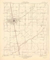
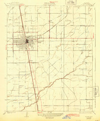
The hub of Tulare dominates the central San Joaquin Valley landscape, where the Southern Pacific and Atchison Topeka and Santa Fe railroads intersect. This 1920s era topography reveals a highly organized agricultural grid, defined by irrigation infrastructure like the Tulare Canal and Prosperity Canal. Beyond the city limits, small rail stops and settlements such as Burling, Elba, and Bates suggest the early shipping points for the region's dairy and fruit production.
Find a feature on this map
21 named features on this map. Tap any name to fly to it.
Don’t see what you’re looking for? This feature index may not catch every label — zoom into the map to look around manually.
Map Details
Editions of this 1927 Tulare Map
3 editions found
Other maps of this area

1925 · Tulare
USGS Topo · 1:31,680

1925 · Tipton
USGS Topo · 1:31,680

1926 · Goshen
USGS Topo · 1:31,680

1926 · Exeter
USGS Topo · 1:31,680

1927 · Cairns Corner
USGS Topo · 1:31,680

1927 · Lake View School
USGS Topo · 1:31,680

1927 · Paige
USGS Topo · 1:31,680

1927 · Visalia
USGS Topo · 1:31,680

1928 · Tipton
USGS Topo · 1:31,680

1928 · Woodville
USGS Topo · 1:31,680