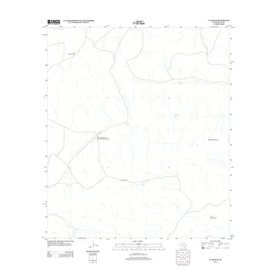
2012 Map of F C Ranch
USGS Topo · Published 2012About this map
Faith Cattle Company and the Longfellow Ranch Airport anchor this high-desert ranching landscape in Pecos County. The map reveals the critical importance of water infrastructure in West Texas, documenting numerous named sources such as Old Ranch Windmill, Steer Tank, and Jimmy Tank scattered across the arid terrain. The physical geography is dominated by the Wildcat Mountains to the east, while the central operations of the F C Ranch sit near the junction of unpaved tracks and Longfellow Rd. This survey illustrates the sprawling nature of modern cattle operations where isolated features like Downie Draw Windmill and Chicken Tank serve as vital landmarks in an otherwise open expanse of scrub and canyon land.
Find a feature on this map
10 named features on this map. Tap any name to fly to it.
Don’t see what you’re looking for? This feature index may not catch every label — zoom into the map to look around manually.
Map Details
Editions of this 2012 F C Ranch Map
This is the sole edition of this map. No revisions or reprints were ever made.
Other maps of this area

1920 · Longfellow
USGS Topo · 1:125,000

1954 · Fort Stockton
USGS Topo · 1:250,000

1958 · Fort Stockton
USGS Topo · 1:250,000

1968 · Cap Rock Butte
USGS Topo · 1:24,000

1968 · Busher Canyon
USGS Topo · 1:24,000

1968 · Toms Canyon
USGS Topo · 1:24,000

1968 · F C Ranch
USGS Topo · 1:24,000

1968 · Longfellow
USGS Topo · 1:24,000

1968 · Ebers Camp
USGS Topo · 1:24,000

1968 · Ninemile Ranch
USGS Topo · 1:24,000