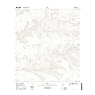
2016 Map of F C Ranch
USGS Topo · Published 2016About this map
The F C Ranch landscape in Pecos County is defined by a complex network of arroyos and draws that drain the Trans-Pecos desert. Large-scale ranching operations are evidenced by the naming of various water collection points, including Vega Tank, Steer Tank, Chicken Tank, and Jimmy Tank. These features were vital for livestock management in a territory characterized by significant elevation changes, particularly around the Wildcat Mountains in the eastern portion of the map. Transport through this terrain relies on Longfellow Rd, which winds past prominent topographic landmarks such as Big Canyon, Rebecca Draw, and Downie Draw. The placement of the F C Ranch headquarters at a central junction of these drainage paths and roads illustrates the strategic geography required for high-desert survival and industry in West Texas.
Find a feature on this map
14 named features on this map. Tap any name to fly to it.
Don’t see what you’re looking for? This feature index may not catch every label — zoom into the map to look around manually.
Map Details
Editions of this 2016 F C Ranch Map
This is the sole edition of this map. No revisions or reprints were ever made.
Other maps of this area

1920 · Longfellow
USGS Topo · 1:125,000

1954 · Fort Stockton
USGS Topo · 1:250,000

1958 · Fort Stockton
USGS Topo · 1:250,000

1968 · Cap Rock Butte
USGS Topo · 1:24,000

1968 · Busher Canyon
USGS Topo · 1:24,000

1968 · Toms Canyon
USGS Topo · 1:24,000

1968 · F C Ranch
USGS Topo · 1:24,000

1968 · Longfellow
USGS Topo · 1:24,000

1968 · Ebers Camp
USGS Topo · 1:24,000

1968 · Ninemile Ranch
USGS Topo · 1:24,000