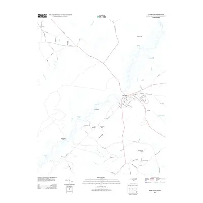
2013 Map of Fair Bluff
USGS Topo · Published 2013About this map
The Lumber River snakes through the landscape, defining the character of this borderland between North Carolina and South Carolina. Along its banks, the town of Fair Bluff serves as a focal point, where streets like Academy St and Railroad St reflect a traditional small-town layout. The river's influence is evident in the numerous named reaches and landings, such as Devils Elbow, Watermelon Bluff, and Sundays Landing, suggesting a long history of riverine transport and recreation. Away from the water, the terrain opens into distinct areas like Sellers Field and the sandy reaches of Big Sandy Ridge. This 2013 survey also documents local infrastructure including Strickland Field Airport and rural clusters like Marietta and Causey. The intricate network of bays and swamps, including Buck Head Bay and Sawscapel Bay, highlights the unique coastal plain hydrology of Columbus County.
Find a feature on this map
83 named features on this map. Tap any name to fly to it.
Don’t see what you’re looking for? This feature index may not catch every label — zoom into the map to look around manually.
Map Details
Editions of this 2013 Fair Bluff Map
This is the sole edition of this map. No revisions or reprints were ever made.
Other maps of this area

1943 · Pages Mill
USGS Topo · 1:62,500

1948 · Nichols
USGS Topo · 1:24,000

1949 · Duford
USGS Topo · 1:24,000

1950 · Nichols
USGS Topo · 1:24,000

1953 · Chadbourn
USGS Topo · 1:62,500

1953 · Florence
USGS Topo · 1:250,000

1954 · Florence
USGS Topo · 1:250,000

1962 · Fair Bluff
USGS Topo · 1:24,000

1962 · Fairmont
USGS Topo · 1:24,000

1962 · Lake View
USGS Topo · 1:24,000