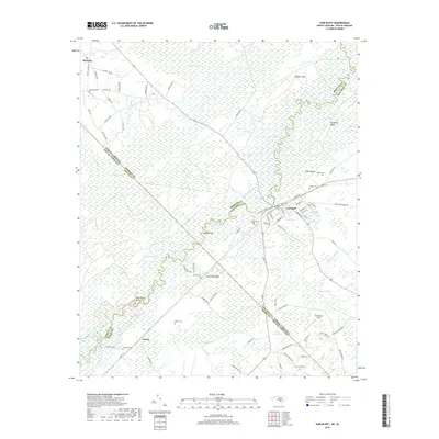
2019 Map of Fair Bluff
USGS Topo · Published 2019About this map
Fair Bluff anchors this borderland landscape, situated along the winding course of the Lumber River as it crosses between North Carolina and South Carolina. This 2019 survey captures the town's street grid and its position as a historic river crossing point at the intersection of Columbus and Robeson Counties. To the northwest, the settlement of Marietta sits near the headwaters of the regional swamp systems, reflecting a settlement pattern deeply tied to the elevation changes between the low-lying wetlands and the agricultural uplands. The map provides a contemporary record of the complex geopolitical boundaries where North Carolina's Columbus and Robeson Counties meet South Carolina's Dillon and Horry Counties, an area historically defined by river transport and the timber-rich swamplands of the coastal plain.
Find a feature on this map
7 named features on this map. Tap any name to fly to it.
Don’t see what you’re looking for? This feature index may not catch every label — zoom into the map to look around manually.
Map Details
Editions of this 2019 Fair Bluff Map
This is the sole edition of this map. No revisions or reprints were ever made.
Other maps of this area

1943 · Pages Mill
USGS Topo · 1:62,500

1948 · Nichols
USGS Topo · 1:24,000

1949 · Duford
USGS Topo · 1:24,000

1950 · Nichols
USGS Topo · 1:24,000

1953 · Chadbourn
USGS Topo · 1:62,500

1953 · Florence
USGS Topo · 1:250,000

1954 · Florence
USGS Topo · 1:250,000

1962 · Fair Bluff
USGS Topo · 1:24,000

1962 · Fairmont
USGS Topo · 1:24,000

1962 · Lake View
USGS Topo · 1:24,000