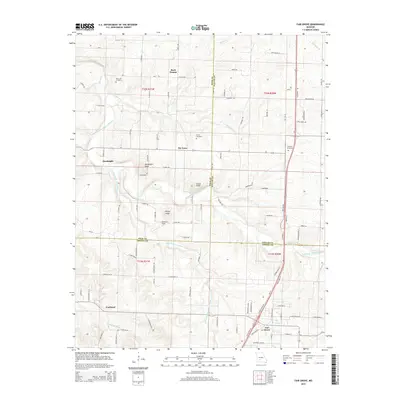
2015 Map of Fair Grove
USGS Topo · Published 2015About this map
Fair Grove serves as a focal point at the junction of modern transit corridors in this Greene County landscape. The topography is defined by the winding course of the Pomme de Terre River and its tributaries, including the Little Pomme de Terre River and N Dry Sac River. These waterways carve through the terrain, leaving prominent elevations such as Goodnight Knob, Lucas Knob, and Henley Knob. Historically rooted rural communities like Tin Town, Rock Prairie, and Goodnight are documented alongside family and local landmarks. For those researching local heritage, the map identifies several burial grounds, including New Life Cemetery, Glover Cemetery, and Mallard Cemetery. The transition from the more settled southern township near Fruitland to the open fields of Marshall Field reflects a classic Ozark agricultural pattern, where farm roads like S 230th Rd and S 240th Rd define the property boundaries and transport network of the mid-2010s.
Find a feature on this map
102 named features on this map. Tap any name to fly to it.
Don’t see what you’re looking for? This feature index may not catch every label — zoom into the map to look around manually.
Map Details
Editions of this 2015 Fair Grove Map
This is the sole edition of this map. No revisions or reprints were ever made.
Other maps of this area

1884 · Springfield
USGS Topo · 1:125,000

1884 · Bolivar
USGS Topo · 1:125,000

1886 · Springfield
USGS Topo · 1:125,000

1892 · Bolivar
USGS Topo · 1:125,000

1946 · Bassville
USGS Topo · 1:24,000

1947 · Strafford
USGS Topo · 1:62,500

1948 · Bassville
USGS Topo · 1:24,000

1948 · Ebenezer
USGS Topo · 1:24,000

1948 · Strafford
USGS Topo · 1:62,500

1954 · Springfield
USGS Topo · 1:250,000