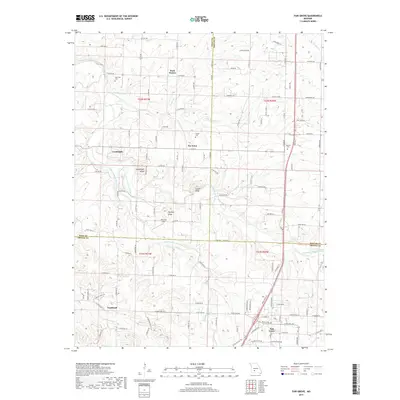
2017 Map of Fair Grove
USGS Topo · Published 2017About this map
Fair Grove serves as a local hub in this rural landscape, situated at the intersection of several regional routes in northern Greene County. The terrain is defined by the winding course of the Pomme de Terre River and its tributaries, including the Little Pomme de Terre River and Little Wilson Cr. High points such as Goodnight Knob, Henley Knob, and Lucas Knob provide prominent landmarks overlooking the dispersed settlements. Small communities and historic locales like Tin Town, Rock Prairie, and Fruitland are scattered across the map, reflecting a classic Missouri Ozarks settlement pattern where families established roots near reliable water sources and along established ridge roads. Local history and genealogy are anchored by sites such as the Glover Cem, Mallard Cem, and the New Life Cem, while Marshall Field indicates the continued importance of regional aviation and land use.
Find a feature on this map
67 named features on this map. Tap any name to fly to it.
Don’t see what you’re looking for? This feature index may not catch every label — zoom into the map to look around manually.
Map Details
Editions of this 2017 Fair Grove Map
This is the sole edition of this map. No revisions or reprints were ever made.
Other maps of this area

1884 · Springfield
USGS Topo · 1:125,000

1884 · Bolivar
USGS Topo · 1:125,000

1886 · Springfield
USGS Topo · 1:125,000

1892 · Bolivar
USGS Topo · 1:125,000

1946 · Bassville
USGS Topo · 1:24,000

1947 · Strafford
USGS Topo · 1:62,500

1948 · Bassville
USGS Topo · 1:24,000

1948 · Ebenezer
USGS Topo · 1:24,000

1948 · Strafford
USGS Topo · 1:62,500

1954 · Springfield
USGS Topo · 1:250,000