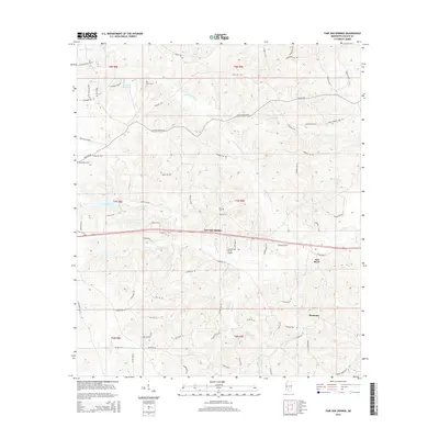
2015 Map of Fair Oak Springs
USGS Topo · Published 2015About this map
Fair Oak Springs and Harmony anchor this Mississippi landscape, illustrating the persistent rural settlement patterns of Lincoln County. The area is defined by the winding course of the Fair River and its primary tributary, the Little Fair River, which create a complex drainage system including Kees Cr, Maxwell Br, and Richey Cr. These watercourses have historically dictated the placement of homesteads and the winding paths of local roads like Nola Rd NE and Old Malcom Rd NE.
Find a feature on this map
80 named features on this map. Tap any name to fly to it.
Don’t see what you’re looking for? This feature index may not catch every label — zoom into the map to look around manually.
Map Details
Editions of this 2015 Fair Oak Springs Map
This is the sole edition of this map. No revisions or reprints were ever made.
Other maps of this area

1953 · Natchez
USGS Topo · 1:250,000

1956 · Natchez
USGS Topo · 1:250,000

1959 · Natchez
USGS Topo · 1:250,000

1970 · Topeka
USGS Topo · 1:24,000

1970 · Nola
USGS Topo · 1:24,000

1971 · Oma
USGS Topo · 1:24,000

1972 · Fair Oak Springs
USGS Topo · 1:24,000

1972 · Ruth
USGS Topo · 1:24,000

1972 · Bogue Chitto
USGS Topo · 1:24,000
1972 · Stronghope
USGS Topo · 1:24,000