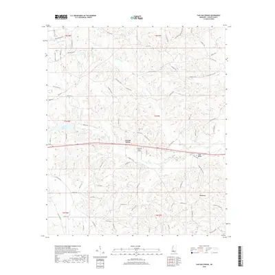
2018 Map of Fair Oak Springs
USGS Topo · Published 2018About this map
Fair Oak Springs and the southern settlement of Harmony anchor this portrait of rural Lincoln County, where the landscape is defined by the winding course of the Fair River and its many tributaries. The area's agricultural and local heritage is preserved through family-named landmarks and historical sites such as Kees Cem, Smith Cem, and Macedonia Cem. The presence of Shadycreek Acres Airport suggests a modern utility amidst the traditional land divisions and timber-rich hillsides.
Find a feature on this map
75 named features on this map. Tap any name to fly to it.
Don’t see what you’re looking for? This feature index may not catch every label — zoom into the map to look around manually.
Map Details
Editions of this 2018 Fair Oak Springs Map
This is the sole edition of this map. No revisions or reprints were ever made.
Other maps of this area

1953 · Natchez
USGS Topo · 1:250,000

1956 · Natchez
USGS Topo · 1:250,000

1959 · Natchez
USGS Topo · 1:250,000

1970 · Topeka
USGS Topo · 1:24,000

1970 · Nola
USGS Topo · 1:24,000

1971 · Oma
USGS Topo · 1:24,000

1972 · Fair Oak Springs
USGS Topo · 1:24,000

1972 · Ruth
USGS Topo · 1:24,000

1972 · Bogue Chitto
USGS Topo · 1:24,000
1972 · Stronghope
USGS Topo · 1:24,000