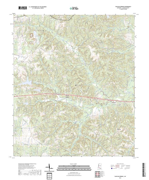
2024 Map of Fair Oak Springs
USGS Topo · Published 2024About this map
Fair Oak Springs lies at the heart of this Lincoln County landscape, where the waters of Kees Creek flow through the central terrain. The settlement pattern is defined by a dense network of local roads such as Nola Rd NE and Warren Rd SE, connecting small rural communities like Fair River and Harmony. The map provides significant genealogical value through the identification of local burial sites, including the Kees Family Cem and Smith Cem, which reflect the long-standing family legacies of this Mississippi region.
Find a feature on this map
77 named features on this map. Tap any name to fly to it.
Don’t see what you’re looking for? This feature index may not catch every label — zoom into the map to look around manually.
Map Details
Editions of this 2024 Fair Oak Springs Map
This is the sole edition of this map. No revisions or reprints were ever made.
Other maps of this area

1953 · Natchez
USGS Topo · 1:250,000

1956 · Natchez
USGS Topo · 1:250,000

1959 · Natchez
USGS Topo · 1:250,000

1970 · Topeka
USGS Topo · 1:24,000

1970 · Nola
USGS Topo · 1:24,000

1971 · Oma
USGS Topo · 1:24,000

1972 · Fair Oak Springs
USGS Topo · 1:24,000

1972 · Ruth
USGS Topo · 1:24,000

1972 · Bogue Chitto
USGS Topo · 1:24,000
1972 · Stronghope
USGS Topo · 1:24,000