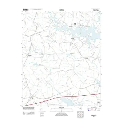
2011 Map of Fair Play
USGS Topo · Published 2011About this map
Hartwell Lake dominates the eastern and southern landscape of this South Carolina territory, creating a complex system of inlets and peninsulas that define modern shoreline communities. Modern residential developments like Snug Harbor, Friendship Shores, and Tokeena Point sit alongside established hubs like Townville and Fair Play. The transition from agrarian land use to a waterfront-oriented economy is evident in the numerous watershed projects, including Beaverdam Watershed Five Lake and Beaverdam Watershed Four Lake, which manage the flow of Little Beaverdam Creek and its tributaries.
Find a feature on this map
160 named features on this map. Tap any name to fly to it.
Don’t see what you’re looking for? This feature index may not catch every label — zoom into the map to look around manually.
Map Details
Editions of this 2011 Fair Play Map
This is the sole edition of this map. No revisions or reprints were ever made.
Other maps of this area

1886 · Walhalla
USGS Topo · 1:125,000

1888 · Pickens
USGS Topo · 1:125,000

1891 · Carnesville
USGS Topo · 1:125,000

1892 · Walhalla
USGS Topo · 1:125,000

1893 · Elberton
USGS Topo · 1:125,000

1894 · Pickens
USGS Topo · 1:125,000

1896 · Walhalla
USGS Topo · 1:125,000

1950 · La France
USGS Topo · 1:24,000

1951 · La France
USGS Topo · 1:24,000

1951 · Clemson
USGS Topo · 1:24,000