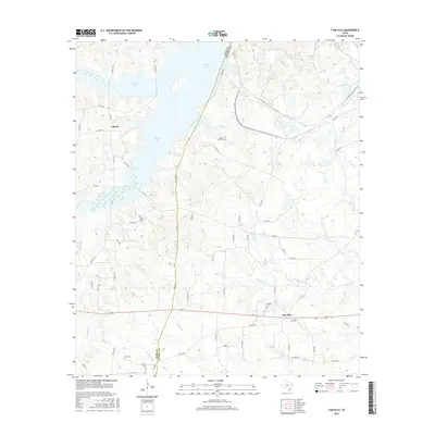
2016 Map of Fair Play
USGS Topo · Published 2016About this map
Martin Lake dominates the northwest quadrant of this East Texas survey, its irregular fingers reaching into a landscape defined by the Rusk Co Panola Co border. Small rural communities like Liberty and Fair Play serve as the primary hubs for a network of farm-to-market roads and county lanes. The geography is notably shaped by numerous watercourses, including Buckner Cr and Caney Cr, which drain the undulating terrain into the reservoir.
Find a feature on this map
65 named features on this map. Tap any name to fly to it.
Don’t see what you’re looking for? This feature index may not catch every label — zoom into the map to look around manually.
Map Details
Editions of this 2016 Fair Play Map
This is the sole edition of this map. No revisions or reprints were ever made.
Other maps of this area

1956 · Tyler
USGS Topo · 1:250,000

1958 · Darco
USGS Topo · 1:62,500

1958 · Carthage
USGS Topo · 1:62,500

1958 · Tatum
USGS Topo · 1:62,500

1960 · Minden
USGS Topo · 1:62,500

1983 · Tatum
USGS Topo · 1:24,000

1983 · Harris Chapel
USGS Topo · 1:24,000
1983 · Church Hill
USGS Topo · 1:24,000

1983 · Long Branch
USGS Topo · 1:24,000

1983 · Fair Play
USGS Topo · 1:24,000