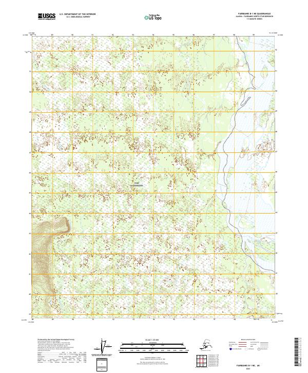
2021 Map of Fairbanks B-1 NE
USGS Topo · Published 2021About this map
The Tanana River dominates the eastern boundary of this interior Alaskan landscape, which is defined by an intricate network of wetlands and shifting waterways. Flowing north of the McDonald Cr drainage, the river's path through the Fairbanks North Star Borough illustrates the dynamic nature of the subarctic floodplain. The terrain is marked by the Public Land Survey System grids of t5s r2e, t5s r3e, t5s r4e, t6s r2e, t6s r3e, and t6s r4e, which provide a structural framework for this otherwise fluid wilderness. This 2021 update from the U.S. Geological Survey utilizes high-resolution elevation data to trace the subtle topographic contours and seasonal water bodies that characterize this portion of the Tanana Valley.
Find a feature on this map
8 named features on this map. Tap any name to fly to it.
Don’t see what you’re looking for? This feature index may not catch every label — zoom into the map to look around manually.
Map Details
Editions of this 2021 Fairbanks B-1 NE Map
This is the sole edition of this map. No revisions or reprints were ever made.
Other maps of this area

1949 · Big Delta B-6
USGS Topo · 1:63,360

1949 · Fairbanks C-1
USGS Topo · 1:63,360

1949 · Big Delta C-6
USGS Topo · 1:63,360

1950 · Fairbanks
USGS Topo · 1:250,000

1950 · Big Delta
USGS Topo · 1:250,000

1950 · Fairbanks C-1
USGS Topo · 1:63,360

1950 · Fairbanks B-1
USGS Topo · 1:63,360

1951 · Big Delta
USGS Topo · 1:250,000
1951 · Fairbanks B-1
USGS Topo · 1:63,360

1951 · Fairbanks
USGS Topo · 1:250,000