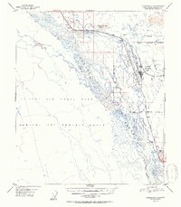
1952 Map of Fairbanks C-1
USGS Topo · Published 1952About this map
The Tanana River and its intricate network of braided waterways dominate this early 1950s landscape, illustrating a region defined by massive military infrastructure and vital transportation corridors. The newly established Eielson Air Force Base stands as a focal point, served by The Alaska Railroad and the Richardson Highway. To the west, the expansive Ladd Air Force Base Bombing and Gunnery Range occupies the territory south of the river, while the Salcha Military Reservation borders the southern reaches.
Find a feature on this map
22 named features on this map. Tap any name to fly to it.
Don’t see what you’re looking for? This feature index may not catch every label — zoom into the map to look around manually.
Map Details
Editions of this 1952 Fairbanks C-1 Map
2 editions found
Other maps of this area

1949 · Fairbanks D-1
USGS Topo · 1:62,500

1949 · Fairbanks D-2
USGS Topo · 1:62,500

1949 · Big Delta B-6
USGS Topo · 1:63,360

1949 · Fairbanks C-1
USGS Topo · 1:63,360

1949 · Big Delta C-6
USGS Topo · 1:63,360

1949 · Fairbanks C-2
USGS Topo · 1:63,360

1950 · Fairbanks
USGS Topo · 1:250,000

1950 · Big Delta
USGS Topo · 1:250,000

1950 · Big Delta D-6
USGS Topo · 1:63,360

1950 · Fairbanks C-1
USGS Topo · 1:63,360