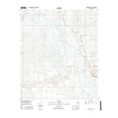
2016 Map of Fairbanks C-1 SE
USGS Topo · Published 2016About this map
The Tanana River and its intricate network of side channels dominate this interior Alaskan landscape, characterized by the winding paths of Piledriver Slough and Salcha Slough. Modern transportation infrastructure follows the corridor established by earlier routes, most notably the Old Rich/Old Valdez Trail @ Salcha which runs parallel to the present-day Richardson Highway. This alignment highlights the persistent importance of this north-south transit artery connecting the interior to the coast.
Find a feature on this map
26 named features on this map. Tap any name to fly to it.
Don’t see what you’re looking for? This feature index may not catch every label — zoom into the map to look around manually.
Map Details
Editions of this 2016 Fairbanks C-1 SE Map
This is the sole edition of this map. No revisions or reprints were ever made.
Other maps of this area

1949 · Big Delta B-6
USGS Topo · 1:63,360

1949 · Fairbanks C-1
USGS Topo · 1:63,360

1949 · Big Delta C-6
USGS Topo · 1:63,360

1950 · Fairbanks
USGS Topo · 1:250,000

1950 · Big Delta
USGS Topo · 1:250,000

1950 · Fairbanks C-1
USGS Topo · 1:63,360

1950 · Fairbanks B-1
USGS Topo · 1:63,360

1951 · Big Delta
USGS Topo · 1:250,000
1951 · Fairbanks B-1
USGS Topo · 1:63,360

1951 · Fairbanks
USGS Topo · 1:250,000