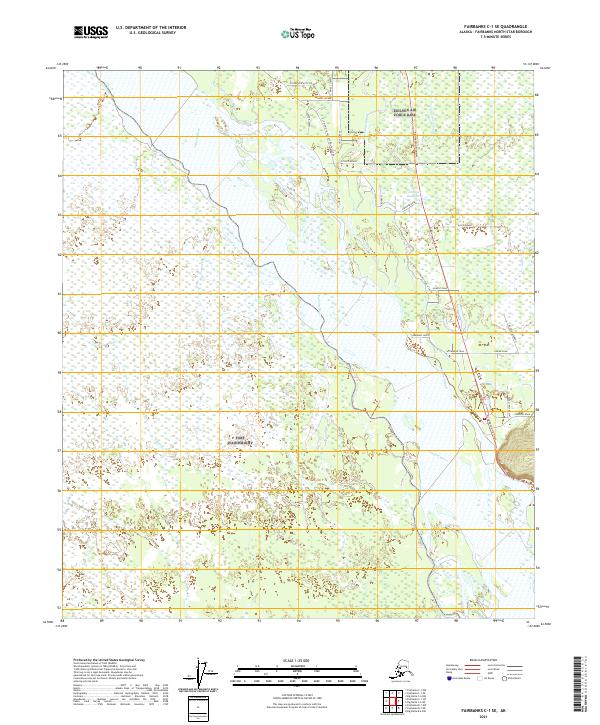
2021 Map of Fairbanks C-1 SE
USGS Topo · Published 2021About this map
The Tanana River and its complex network of waterways dominate this portion of the Fairbanks North Star Borough. The landscape is defined by the shifting paths of the Piledriver Slough, Twentythree Mile Slough, and Salcha Slough, which weave through the low-lying terrain. Human infrastructure is concentrated primarily along the eastern edge of the survey, where the Richardson Highway provides the main artery for travel. Historically significant routes, such as the Old Rich-Old Valdez Trail @ Salcha, offer a glimpse into the early transportation corridors used before modern development. Residential and local access roads like Stormdoor Alice Drive, Swede Avenue, and Howell Road branch off the highway, while the southern reaches of the map near the Little Salcha River remain largely defined by the natural riverine environment.
Find a feature on this map
35 named features on this map. Tap any name to fly to it.
Don’t see what you’re looking for? This feature index may not catch every label — zoom into the map to look around manually.
Map Details
Editions of this 2021 Fairbanks C-1 SE Map
This is the sole edition of this map. No revisions or reprints were ever made.
Other maps of this area

1949 · Big Delta B-6
USGS Topo · 1:63,360

1949 · Fairbanks C-1
USGS Topo · 1:63,360

1949 · Big Delta C-6
USGS Topo · 1:63,360

1950 · Fairbanks
USGS Topo · 1:250,000

1950 · Big Delta
USGS Topo · 1:250,000

1950 · Fairbanks C-1
USGS Topo · 1:63,360

1950 · Fairbanks B-1
USGS Topo · 1:63,360

1951 · Big Delta
USGS Topo · 1:250,000
1951 · Fairbanks B-1
USGS Topo · 1:63,360

1951 · Fairbanks
USGS Topo · 1:250,000