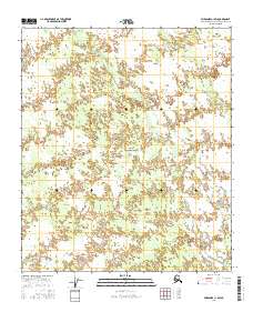
2016 Map of Fairbanks C-1 SW
USGS Topo · Published 2016About this map
McDonald Cr and Bear Cr drain this expansive Alaskan landscape southeast of Fairbanks, as recorded in this 2016 topographic study. The area is defined by the rigid grid of the Public Land Survey System, including portions of t3s r1e, t3s r2e, t4s r1e, t4s r2e, t5s r1e, and t5s r2e. The drainage patterns and wetland signatures suggest a terrain where seasonal water movement is the primary geographical driver. While devoid of named settlements or heavy infrastructure, the map provides a precise baseline for the hydrological network and township boundaries in this part of the Fairbanks North Star Borough.
Find a feature on this map
8 named features on this map. Tap any name to fly to it.
Don’t see what you’re looking for? This feature index may not catch every label — zoom into the map to look around manually.
Map Details
Editions of this 2016 Fairbanks C-1 SW Map
This is the sole edition of this map. No revisions or reprints were ever made.
Other maps of this area

1949 · Fairbanks C-1
USGS Topo · 1:63,360

1949 · Fairbanks C-2
USGS Topo · 1:63,360

1950 · Fairbanks
USGS Topo · 1:250,000

1950 · Fairbanks C-1
USGS Topo · 1:63,360

1950 · Fairbanks B-2
USGS Topo · 1:63,360

1950 · Fairbanks B-1
USGS Topo · 1:63,360
1951 · Fairbanks B-1
USGS Topo · 1:63,360
1951 · Fairbanks B-2
USGS Topo · 1:63,360

1951 · Fairbanks
USGS Topo · 1:250,000

1952 · Fairbanks C-2
USGS Topo · 1:63,360