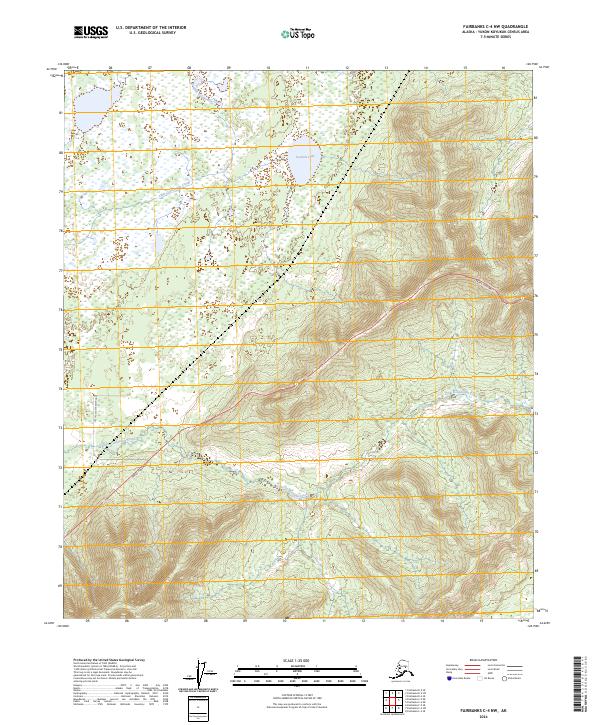
2024 Map of Fairbanks C-4 NW
USGS Topo · Published 2024About this map
Little Goldstream Creek winds through this interior Alaskan landscape, defining the drainage patterns south of the expansive Twomile Lake. This modern survey illustrates a rugged terrain where the Parks Highway provides the primary transit artery, cutting diagonally across the topography to link this northern wilderness. Secondary access is provided by Little Goldstream Road, which penetrates the western reaches of the quadrangle. The map detail reflects the Public Land Survey System divisions between t2s r6w and surrounding townships, offering a precise look at the land boundaries in the Yukon-Koyukuk Census Area. While largely dominated by complex hydrology and wetlands, the presence of established roads among the various forks of the creek suggests the ongoing role of this corridor in regional connectivity.
Find a feature on this map
8 named features on this map. Tap any name to fly to it.
Don’t see what you’re looking for? This feature index may not catch every label — zoom into the map to look around manually.
Map Details
Editions of this 2024 Fairbanks C-4 NW Map
This is the sole edition of this map. No revisions or reprints were ever made.
Other maps of this area

1949 · Fairbanks D-4
USGS Topo · 1:63,360

1950 · Fairbanks
USGS Topo · 1:250,000

1950 · Fairbanks C-5
USGS Topo · 1:63,360

1950 · Fairbanks C-4
USGS Topo · 1:63,360

1950 · Fairbanks D-5
USGS Topo · 1:63,360

1951 · Fairbanks
USGS Topo · 1:250,000

1952 · Fairbanks C-4
USGS Topo · 1:63,360

1952 · Fairbanks D-4
USGS Topo · 1:63,360
1952 · Fairbanks C-5
USGS Topo · 1:63,360

1952 · Fairbanks
USGS Topo · 1:250,000