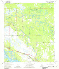
1966 Map of Fairbanks D-1 SW
USGS Topo · Published 1982About this map
North Pole serves as the focal point for development in this Alaskan interior landscape, positioned along the transport corridor shared by The Alaska Railroad and the Richardson Highway. The map illustrates the town's expansion with residential developments like Highland Park and local aviation infrastructure including Bradley Sky Ranch and the Wrights Landing Strip. The complex hydrology of the region is evident in the meandering Chena River and Chena Slough, which dominate the northern and central sections before meeting the broad Tanana River near the Fort Wainwright Military Reservation boundary.
Find a feature on this map
40 named features on this map. Tap any name to fly to it.
Don’t see what you’re looking for? This feature index may not catch every label — zoom into the map to look around manually.
Map Details
Editions of this 1966 Fairbanks D-1 SW Map
2 editions found
Other maps of this area

1949 · Fairbanks D-1
USGS Topo · 1:62,500

1949 · Fairbanks D-2
USGS Topo · 1:62,500

1949 · Fairbanks C-1
USGS Topo · 1:63,360

1949 · Fairbanks C-2
USGS Topo · 1:63,360

1950 · Fairbanks
USGS Topo · 1:250,000

1950 · Fairbanks C-1
USGS Topo · 1:63,360

1951 · Fairbanks
USGS Topo · 1:250,000

1952 · Fairbanks C-2
USGS Topo · 1:63,360

1952 · Fairbanks D-2
USGS Topo · 1:63,360
1952 · Fairbanks C-1
USGS Topo · 1:63,360