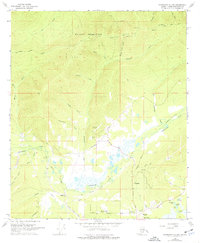
1966 Map of Fairbanks D-2 NW
USGS Topo · Published 1977About this map
Murphy Dome and the high northern ridges dominate this Alaskan interior landscape, looking down over the intricate drainage patterns of Goldstream Creek and its many tributaries. In the mid-1960s, the area south of the ridge displays a growing network of roads and small settlements like Happy and Dogpatch. Evidence of the region’s extractive history is clearly visible through the Dredge Tailings along Sheep Creek and several identified Mines and Gravel Pits.
Find a feature on this map
52 named features on this map. Tap any name to fly to it.
Don’t see what you’re looking for? This feature index may not catch every label — zoom into the map to look around manually.
Map Details
Editions of this 1966 Fairbanks D-2 NW Map
2 editions found
Other maps of this area

1945 · Livengood
USGS Topo · 1:250,000

1949 · Fairbanks D-2
USGS Topo · 1:62,500

1949 · Fairbanks D-3
USGS Topo · 1:63,360

1950 · Fairbanks
USGS Topo · 1:250,000

1950 · Fairbanks D-3
USGS Topo · 1:63,360

1951 · Fairbanks
USGS Topo · 1:250,000

1951 · Livengood
USGS Topo · 1:250,000

1952 · Fairbanks D-2
USGS Topo · 1:63,360

1952 · Fairbanks D-3
USGS Topo · 1:63,360

1952 · Fairbanks
USGS Topo · 1:250,000