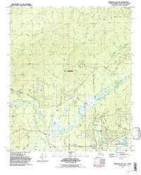
1992 Map of Fairbanks D-2 NW
USGS Topo · Published 1992About this map
Goldstream Creek and its many tributaries, including Happy Creek and O'Connor Creek, define the drainage patterns northwest of Fairbanks during the early 1990s. The landscape is a complex mix of subarctic wetlands and interior Alaskan uplands, marked by an Old Railroad Grade and an extensive network of winter trails. Local development is concentrated along corridors like Ballaine Road and Miller Hill Road, where the Pearl Creek Sch and Northern Lights Memorial Cem serve the growing community. Scientific and conservation interests are prominent, featuring the Eielson Alaska Long Period Array Research Site and the southern reaches of the Creamer's Field State Migratory Waterfowl Refuge. Mining activity remains visible through various Prospects and an Open Pit Mine near the western edge of the survey.
Find a feature on this map
55 named features on this map. Tap any name to fly to it.
Don’t see what you’re looking for? This feature index may not catch every label — zoom into the map to look around manually.
Map Details
Editions of this 1992 Fairbanks D-2 NW Map
2 editions found
Other maps of this area

1945 · Livengood
USGS Topo · 1:250,000

1949 · Fairbanks D-2
USGS Topo · 1:62,500

1949 · Fairbanks D-3
USGS Topo · 1:63,360

1950 · Fairbanks
USGS Topo · 1:250,000

1950 · Fairbanks D-3
USGS Topo · 1:63,360

1951 · Fairbanks
USGS Topo · 1:250,000

1951 · Livengood
USGS Topo · 1:250,000

1952 · Fairbanks D-2
USGS Topo · 1:63,360

1952 · Fairbanks D-3
USGS Topo · 1:63,360

1952 · Fairbanks
USGS Topo · 1:250,000