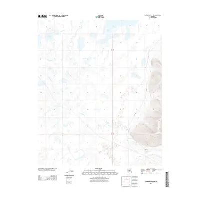
2013 Map of Fairbanks D-4 SW
USGS Topo · Published 2013About this map
Goldstream Cr meanders through a low-lying interior landscape dominated by the extensive Minto Lakes system in this 2013 survey. The terrain is characterized by a high density of small water bodies, including Wooden Canoe Lake and Bridge Lake, which together form a complex aquatic network. This region’s transport history is visible in the presence of the Sled Rd, reflecting traditional methods of winter travel across the northern expanse where seasonal frozen ground provides the most reliable transit routes. In the southeastern corner, the settlement of Dunbar sits near the base of rising elevations, marking a rare point of named habitation in an area otherwise defined by its hydrological features. The convergence of these lakes and drainage systems suggests a landscape that is seasonally dynamic and fundamentally tied to the movement of water and ice.
Find a feature on this map
9 named features on this map. Tap any name to fly to it.
Don’t see what you’re looking for? This feature index may not catch every label — zoom into the map to look around manually.
Map Details
Editions of this 2013 Fairbanks D-4 SW Map
This is the sole edition of this map. No revisions or reprints were ever made.
Other maps of this area

1949 · Fairbanks D-4
USGS Topo · 1:63,360

1950 · Fairbanks
USGS Topo · 1:250,000

1950 · Fairbanks C-5
USGS Topo · 1:63,360

1950 · Fairbanks C-4
USGS Topo · 1:63,360

1950 · Fairbanks D-5
USGS Topo · 1:63,360

1951 · Fairbanks
USGS Topo · 1:250,000

1952 · Fairbanks C-4
USGS Topo · 1:63,360

1952 · Fairbanks D-4
USGS Topo · 1:63,360
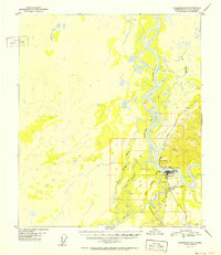
1952 · Fairbanks C-5
USGS Topo · 1:63,360

1952 · Fairbanks
USGS Topo · 1:250,000