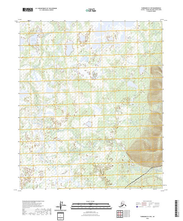
2024 Map of Fairbanks D-4 SW
USGS Topo · Published 2024About this map
Goldstream Creek meanders extensively through the wetland-dominated interior of the Yukon-Koyukuk Census Area in this modern survey. The landscape is defined by its complex hydrology, where Little Goldstream Creek and larger water bodies like Wooden Canoe Lake sit amidst a mosaic of marshes and small ponds. The topography is predominantly low-lying, transitioning only as the terrain rises into the more defined ridges of the eastern edge of the quadrangle. This 2024 map documents the current state of these subarctic waterways and the surrounding wilderness, showing the intricate drainage patterns of the Goldstream Creek basin. The survey is a clear record of the area's natural boundaries and public land survey system divisions, illustrating how water shapes the interior Alaskan geography.
Find a feature on this map
9 named features on this map. Tap any name to fly to it.
Don’t see what you’re looking for? This feature index may not catch every label — zoom into the map to look around manually.
Map Details
Editions of this 2024 Fairbanks D-4 SW Map
This is the sole edition of this map. No revisions or reprints were ever made.
Other maps of this area

1949 · Fairbanks D-4
USGS Topo · 1:63,360

1950 · Fairbanks
USGS Topo · 1:250,000

1950 · Fairbanks C-5
USGS Topo · 1:63,360

1950 · Fairbanks C-4
USGS Topo · 1:63,360

1950 · Fairbanks D-5
USGS Topo · 1:63,360

1951 · Fairbanks
USGS Topo · 1:250,000

1952 · Fairbanks C-4
USGS Topo · 1:63,360

1952 · Fairbanks D-4
USGS Topo · 1:63,360
1952 · Fairbanks C-5
USGS Topo · 1:63,360

1952 · Fairbanks
USGS Topo · 1:250,000