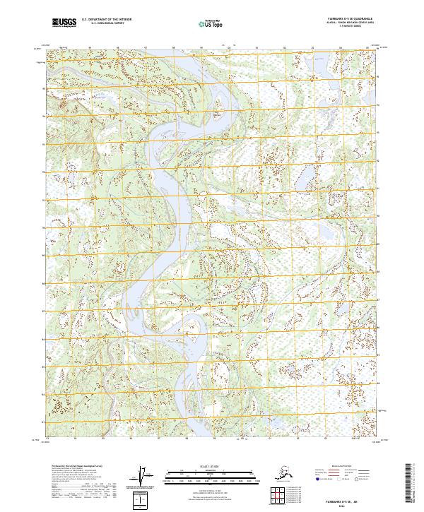
2024 Map of Fairbanks D-5 SE
USGS Topo · Published 2024About this map
The Tanana River dominates this landscape in the Yukon-Koyukuk Census Area, carving a complex network of waterways across the interior of Alaska. This modern survey illustrates a dynamic riparian environment where the main river channel is flanked by extensive secondary systems, including Sawmill Slough and Twentyfour Mile Slough. The land is characterized by numerous seasonal wetlands and small water bodies like Big Lake, typical of the low-lying Tanana valley. Indigenous placenames are preserved on the map, such as Gux Neetseeł and Teyh Tox Dagheeyee, providing essential cultural context to these northern reaches. In the southern portion of the sheet, the Totchaket Slough meanders through the wetlands, showing the intricate drainage patterns that define this undeveloped wilderness near the confluence of major interior waterways.
Find a feature on this map
14 named features on this map. Tap any name to fly to it.
Don’t see what you’re looking for? This feature index may not catch every label — zoom into the map to look around manually.
Map Details
Editions of this 2024 Fairbanks D-5 SE Map
This is the sole edition of this map. No revisions or reprints were ever made.
Other maps of this area

1949 · Fairbanks D-4
USGS Topo · 1:63,360

1950 · Fairbanks
USGS Topo · 1:250,000

1950 · Fairbanks C-5
USGS Topo · 1:63,360

1950 · Fairbanks C-4
USGS Topo · 1:63,360

1950 · Fairbanks D-5
USGS Topo · 1:63,360

1951 · Fairbanks
USGS Topo · 1:250,000

1952 · Fairbanks C-4
USGS Topo · 1:63,360

1952 · Fairbanks D-4
USGS Topo · 1:63,360
1952 · Fairbanks C-5
USGS Topo · 1:63,360

1952 · Fairbanks
USGS Topo · 1:250,000