Loading...
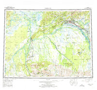
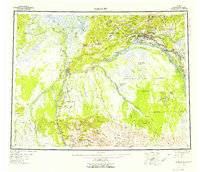
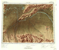
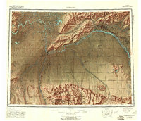
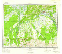
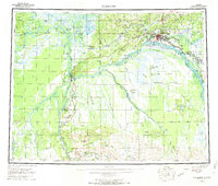
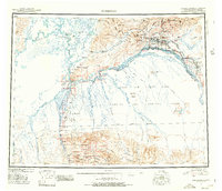
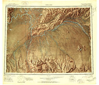
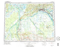
Loading map...1952 Map of Fairbanks
USGS Topo · Published 1974About this map
The confluence of the Chena River and the Tanana River anchors this interior Alaskan landscape during a period of significant military and infrastructure development. The urban centers of Fairbanks and College serve as the regional hub, connected to the south by The Alaska Railroad as it follows the Nenana River corridor. This era is defined by the Cold War presence of the Clear Missile Early Warning Station and the sprawling Fort Wainwright Military Reservation, illustrating the strategic importance of the region.
Find a feature on this map
55 named features on this map. Tap any name to fly to it.
Don’t see what you’re looking for? This feature index may not catch every label — zoom into the map to look around manually.
Map Details
Date Portrayed1952
Date Published1974
PublisherU.S. Geological Survey
Map TypeTopographic
Scale1:250,000
Physical Dimensions26 x 24.3 inches
Editions of this 1952 Fairbanks Map
6 editions found
Historical Maps of Fairbanks Through Time
5 maps found
Featured Locations
Source Details
SourceU.S. Geological Survey
CopyrightPublic Domain