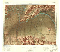
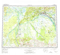
1952 Map of Fairbanks
USGS Topo · Published 1960About this map
Fairbanks serves as the focal point of this mid-century survey, situated at the confluence of the Chena River and the sprawling Tanana River system. The map documents the vital logistics of the Alaskan interior, anchored by the route of The Alaska Railroad as it winds through settlements like Nenana and Browne. To the southeast, the growing community of North Pole and the strategic presence of Eielson Air Force Base reflect the Cold War era expansion of the region.
Find a feature on this map
51 named features on this map. Tap any name to fly to it.
Don’t see what you’re looking for? This feature index may not catch every label — zoom into the map to look around manually.
Map Details
Editions of this 1952 Fairbanks Map
6 editions found

Other maps of this area

1945 · Livengood
USGS Topo · 1:250,000

1948 · Kantishna River
USGS Topo · 1:250,000

1949 · Fairbanks D-1
USGS Topo · 1:62,500

1949 · Fairbanks D-2
USGS Topo · 1:62,500

1949 · Big Delta B-6
USGS Topo · 1:63,360

1949 · Fairbanks B-5
USGS Topo · 1:63,360

1949 · Fairbanks C-1
USGS Topo · 1:63,360

1949 · Fairbanks D-3
USGS Topo · 1:63,360

1949 · Big Delta C-6
USGS Topo · 1:63,360

1949 · Fairbanks D-4
USGS Topo · 1:63,360