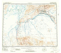
1956 Map of Fairbanks
USGS Topo · Published 1978About this map
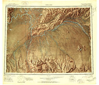
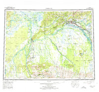
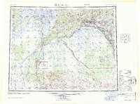
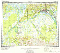
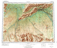
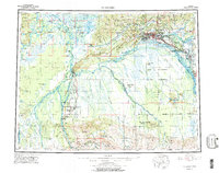
The confluence of the Tanana River and the Chena River defines the layout of the interior's most prominent settlement at the midpoint of the twentieth century. This map traces the established footprint of Fairbanks and its expansion toward College, where the university and rail lines converge. The strategic importance of the Cold War era is evident in the presence of the Clear Missile Early Warning Station and the sprawling Fort Wainwright Military Reservation. Beyond the urban centers, the Alaska Railroad snakes south toward Nenana and Browne, passing through low-lying marshlands and island systems like Sawmill Island. To the south and east, the terrain rises into the Japan Hills and Rex Dome, where industrial extraction is noted at sites like the Liberty Bell Mine. This map documents a critical period where frontier mining traditions began to share the landscape with large-scale military infrastructure and regional aviation hubs.
Find a feature on this map
78 named features on this map. Tap any name to fly to it.
Don’t see what you’re looking for? This feature index may not catch every label — zoom into the map to look around manually.
Map Details
Editions of this 1956 Fairbanks Map
3 editions found
Historical Maps of Fairbanks Through Time
5 maps found