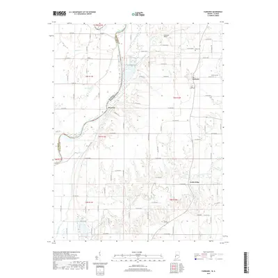
2019 Map of Fairbanks
USGS Topo · Published 2019About this map
The Wabash River serves as the dividing line between Sullivan County, Indiana and Clark County, Illinois, carving a wide valley through this agricultural landscape. The settlement of Fairbanks sits on the eastern upland, while the small community of Riverview overlooks the river's eastern bank. The terrain is defined by the winding paths of Turman Creek and Welsh Creek, which feed into the Wabash through wooded ravines. Local history is deeply embedded in the land, from the elevated Fairbanks Mound north of town to a network of rural burial sites like the DeBaun Cem and Walnut Prairie Cem. To the south, Ladd Hill rises above the bottomlands near the crossing at Dodds Bridge, illustrating how early residents navigated the wetlands of Kelley Bayou and the seasonal flooding of the river valley.
Find a feature on this map
83 named features on this map. Tap any name to fly to it.
Don’t see what you’re looking for? This feature index may not catch every label — zoom into the map to look around manually.
Map Details
Editions of this 2019 Fairbanks Map
This is the sole edition of this map. No revisions or reprints were ever made.
Other maps of this area

1932 · Marshall
USGS Topo · 1:62,500

1937 · Marshall
USGS Topo · 1:62,500

1940 · Pimento
USGS Topo · 1:24,000

1942 · Fairbanks
USGS Topo · 1:24,000

1942 · Shelburn
USGS Topo · 1:24,000

1942 · Hutton
USGS Topo · 1:24,000

1943 · Merom
USGS Topo · 1:24,000

1943 · Sullivan
USGS Topo · 1:24,000

1952 · Fairbanks
USGS Topo · 1:24,000

1952 · Shelburn
USGS Topo · 1:24,000