
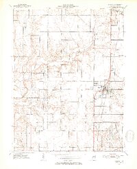
1952 Map of Shelburn
USGS Topo · Published 1953About this map
Shelburn and Farmersburg serve as the primary anchors of this mid-century Sullivan County landscape, where the Chicago and Eastern Illinois railroad corridor dictates the path of development. The area is characterized by a high density of rural institutions, including Douglas Chapel Ch, Concord Ch, and Benson Ch, alongside numerous family and community burial grounds such as McKinley Cem and Little Flock Cem. These sites, scattered across the townships of Curry, Hamilton, and Fairbanks, reflect a deeply rooted agricultural and coal-mining society.
Find a feature on this map
29 named features on this map. Tap any name to fly to it.
Don’t see what you’re looking for? This feature index may not catch every label — zoom into the map to look around manually.
Map Details
Editions of this 1952 Shelburn Map
2 editions found
Other maps of this area

1932 · Marshall
USGS Topo · 1:62,500

1937 · Marshall
USGS Topo · 1:62,500

1940 · Lewis
USGS Topo · 1:24,000

1940 · Pimento
USGS Topo · 1:24,000

1942 · Fairbanks
USGS Topo · 1:24,000

1942 · Shelburn
USGS Topo · 1:24,000

1942 · Hutton
USGS Topo · 1:24,000

1943 · Merom
USGS Topo · 1:24,000

1943 · Hymera
USGS Topo · 1:24,000

1943 · Sullivan
USGS Topo · 1:24,000