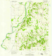
1957 Map of Fairbanks
USGS Topo · Published 1958About this map
The Wabash River meanders across the border of Indiana and Illinois, anchoring a landscape shaped by both natural waterways and early human habitation. On the Indiana side, the community of Fairbanks sits atop the higher ground of Fairbanks township, while the Illinois bank features the town of Hutsonville and the small riverside settlement of Riverview. The map reveals a deeply etched rural character, with numerous local landmarks marking the social and spiritual life of the mid-20th century.
Find a feature on this map
35 named features on this map. Tap any name to fly to it.
Don’t see what you’re looking for? This feature index may not catch every label — zoom into the map to look around manually.
Map Details
Editions of this 1957 Fairbanks Map
This is the sole edition of this map. No revisions or reprints were ever made.
Other maps of this area

1932 · Marshall
USGS Topo · 1:62,500

1937 · Marshall
USGS Topo · 1:62,500

1940 · Pimento
USGS Topo · 1:24,000

1942 · Fairbanks
USGS Topo · 1:24,000

1942 · Shelburn
USGS Topo · 1:24,000

1942 · Hutton
USGS Topo · 1:24,000

1943 · Merom
USGS Topo · 1:24,000

1943 · Sullivan
USGS Topo · 1:24,000

1952 · Fairbanks
USGS Topo · 1:24,000

1952 · Shelburn
USGS Topo · 1:24,000