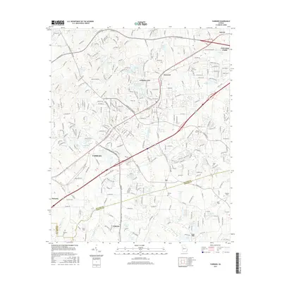
2017 Map of Fairburn
USGS Topo · Published 2017About this map
Union City and Fairburn anchor this 2017 survey of the southwest Atlanta metro corridor, where suburban development meets the historical landscape of Fulton and Fayette Counties. The area is densely patterned with neighborhood reservoirs and larger water bodies like Lake Feldwood and Lake Frances, reflecting the residential expansion that has transformed the terrain since the mid-twentieth century. Amidst the modern street grids of College Park and Tyrone, legacy features remain visible, including several family and community burial grounds such as Forest Lawn Cem and Peters Cem. Small airfield operations like Smith Field and Beck Field punctuate the landscape, while the southern reach of the map preserves older site names like Lees Mill, documenting the long-standing water-powered and agricultural history that preceded the modern transit networks of the South Fulton Parkway.
Find a feature on this map
295 named features on this map. Tap any name to fly to it.
Don’t see what you’re looking for? This feature index may not catch every label — zoom into the map to look around manually.
Map Details
Editions of this 2017 Fairburn Map
This is the sole edition of this map. No revisions or reprints were ever made.
Other maps of this area

1888 · Atlanta
USGS Topo · 1:125,000

1890 · Atlanta
USGS Topo · 1:125,000

1891 · Marietta
USGS Topo · 1:125,000

1892 · Atlanta
USGS Topo · 1:125,000

1895 · Atlanta
USGS Topo · 1:125,000

1895 · Marietta
USGS Topo · 1:125,000

1897 · Marietta
USGS Topo · 1:125,000

1901 · Marietta
USGS Topo · 1:125,000

1953 · Atlanta
USGS Topo · 1:250,000

1954 · Palmetto
USGS Topo · 1:24,000